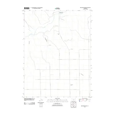
2010 Map of Beecher Island
USGS Topo · Published 2010About this map
Beecher Island anchors this eastern Colorado landscape where the Arikaree River carves a winding path through the plains of Yuma County. This modern survey illustrates a rural environment defined by a rigid grid of county roads, including County Road KK and County Road 15, which contrast with the natural drainages of Sand Creek and Jacks Gulch. The settlement pattern is sparse, centered on agricultural operations like the M K Ranch and the localized geography of Lansing Valley.
Find a feature on this map
25 named features on this map. Tap any name to fly to it.
Don’t see what you’re looking for? This feature index may not catch every label — zoom into the map to look around manually.
Map Details
Editions of this 2010 Beecher Island Map
This is the sole edition of this map. No revisions or reprints were ever made.
Other maps of this area

1950 · Bonny Reservoir
USGS Topo · 1:62,500

1954 · Limon
USGS Topo · 1:250,000

1957 · Limon
USGS Topo · 1:250,000

1958 · Limon
USGS Topo · 1:250,000

1963 · Vernon
USGS Topo · 1:24,000

1963 · Beecher Island
USGS Topo · 1:24,000
1963 · Armel
USGS Topo · 1:24,000

1963 · Beecher Island NW
USGS Topo · 1:24,000
1963 · Willow Creek Ranch
USGS Topo · 1:24,000

1963 · Wildcat Canyon
USGS Topo · 1:24,000