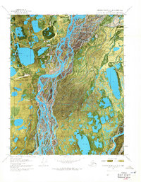
1970 Map of Beechey Point A-3 NE
USGS Topo · Published 1971About this map
Industrial outposts and gravel pads dot the wet tundra of the North Slope in this orthophotomap, which utilizes 1970 aerial photography to document the early infrastructure of the oil era. The settlement of Deadhorse serves as a focal point for the region's development, supported by a nearby Airfield and a network of specialized installations including Halliburton Camp, Burgess Camp, and Magley Camp. The landscape is defined by the braided channels of northern river systems and an array of technical features such as Central Pad 1, Central Pad 2, and Central Pad 3. This edition captures the specific moment when exploration was transforming the geography of the Arctic coast, evidenced by scattered Drill Holes and the Winter Trail that provided seasonal access across the permafrost.
Find a feature on this map
14 named features on this map. Tap any name to fly to it.
Don’t see what you’re looking for? This feature index may not catch every label — zoom into the map to look around manually.
Map Details
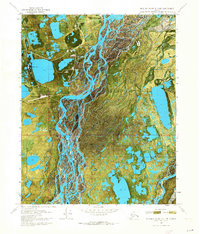
Editions of this 1970 Beechey Point A-3 NE Map
2 editions found
Other maps of this area

1951 · Beechey Point
USGS Topo · 1:250,000

1955 · Beechey Point
USGS Topo · 1:250,000

1955 · Beechey Point B-2
USGS Topo · 1:63,360

1955 · Beechey Point A-2
USGS Topo · 1:63,360

1955 · Beechey Point A-3
USGS Topo · 1:63,360

1955 · Beechey Point B-3
USGS Topo · 1:63,360

1960 · Beechey Point
USGS Topo · 1:250,000

1962 · Beechey Point B-2
USGS Topo · 1:50,000
1962 · Beechey Point A-2
USGS Topo · 1:50,000

1964 · Beechey Point
USGS Topo · 1:250,000