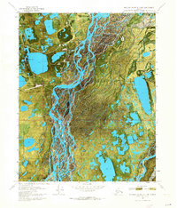
1970 Map of Beechey Point A-3 NE
USGS Topo · Published 1973About this map
Industrial expansion in the North Slope is captured in this orthophotomap, showing the early infrastructure of the Prudhoe Bay oil field. The settlement at Deadhorse serves as a central hub, supported by a specialized Airfield and various support facilities including Halliburton Camp and Burgess Camp. The terrain is characterized by a complex network of braided river channels and hundreds of small ponds and lakes, with the Put River flowing through the tundra landscape.
Find a feature on this map
14 named features on this map. Tap any name to fly to it.
Don’t see what you’re looking for? This feature index may not catch every label — zoom into the map to look around manually.
Map Details
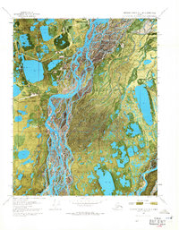
Editions of this 1970 Beechey Point A-3 NE Map
2 editions found
Other maps of this area

1951 · Beechey Point
USGS Topo · 1:250,000

1955 · Beechey Point
USGS Topo · 1:250,000

1955 · Beechey Point B-2
USGS Topo · 1:63,360

1955 · Beechey Point A-2
USGS Topo · 1:63,360

1955 · Beechey Point A-3
USGS Topo · 1:63,360

1955 · Beechey Point B-3
USGS Topo · 1:63,360

1960 · Beechey Point
USGS Topo · 1:250,000

1962 · Beechey Point B-2
USGS Topo · 1:50,000
1962 · Beechey Point A-2
USGS Topo · 1:50,000

1964 · Beechey Point
USGS Topo · 1:250,000