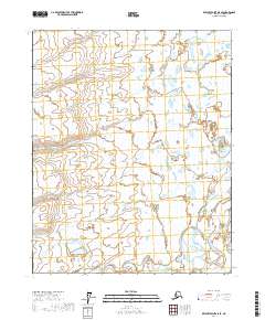
2017 Map of Beechey Point A-5 SE
USGS Topo · Published 2017About this map
The Kuparuk River winds through this expanse of the North Slope, carving a path through a landscape dominated by Arctic wetlands and complex hydrography. This 2017 survey captures the remote character of the region within the North Slope Borough, where the river's course is the primary geographical anchor amidst a dense network of seasonal water bodies. The map is primarily organized by the Public Land Survey System grids, specifically T9n R10e, T9n R11e, T8n R10e, and T8n R11e. These township and range designations reflect the systematic administrative oversight of this mineral-rich territory, showing the terrain as it appeared before further industrial or infrastructure shifts in the 21st century.
Find a feature on this map
5 named features on this map. Tap any name to fly to it.
Don’t see what you’re looking for? This feature index may not catch every label — zoom into the map to look around manually.
Map Details
Editions of this 2017 Beechey Point A-5 SE Map
This is the sole edition of this map. No revisions or reprints were ever made.
Other maps of this area

1951 · Beechey Point
USGS Topo · 1:250,000

1951 · Sagavanirktok D-5
USGS Topo · 1:250,000

1955 · Beechey Point
USGS Topo · 1:250,000

1955 · Beechey Point A-5
USGS Topo · 1:63,360

1955 · Beechey Point A-4
USGS Topo · 1:63,360
1955 · Sagavanirktok D-5
USGS Topo · 1:63,360

1955 · Sagavanirktok D-4
USGS Topo · 1:63,360

1956 · Sagavanirktok
USGS Topo · 1:250,000

1958 · Sagavanirktok
USGS Topo · 1:250,000

1960 · Beechey Point
USGS Topo · 1:250,000