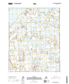
2017 Map of Beechey Point B-5 NW
USGS Topo · Published 2017About this map
Simpson Lagoon dominates the northern coastline of this Arctic landscape, where the shallow waters of the Beaufort Sea meet the low-lying tundra of the North Slope. The terrain is characterized by a dense concentration of thaw lakes and wetlands, typical of the coastal plain's permafrost environment. Flowing toward the northern coast, the Ugnuravik River winds through the eastern portion of the map, carving a path through the flat, saturated soils. A singular topographic exception in this nearly level expanse is Thetis Mound, a localized elevation that stands out against the surrounding marshes. This map illustrates the intersection of vast natural water systems and the administrative divisions of the Public Land Survey System, including t13n r9e and t12n r9e, in a region where geography is defined by seasonal water movement.
Find a feature on this map
8 named features on this map. Tap any name to fly to it.
Don’t see what you’re looking for? This feature index may not catch every label — zoom into the map to look around manually.
Map Details
Editions of this 2017 Beechey Point B-5 NW Map
This is the sole edition of this map. No revisions or reprints were ever made.
Other maps of this area

1951 · Harrison Bay
USGS Topo · 1:250,000

1951 · Beechey Point
USGS Topo · 1:250,000

1955 · Harrison Bay
USGS Topo · 1:250,000

1955 · Beechey Point
USGS Topo · 1:250,000

1955 · Harrison Bay C-1
USGS Topo · 1:63,360

1955 · Harrison Bay B-1
USGS Topo · 1:63,360
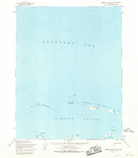
1955 · Beechey Point C-5
USGS Topo · 1:63,360

1955 · Beechey Point B-5
USGS Topo · 1:63,360

1960 · Beechey Point
USGS Topo · 1:250,000
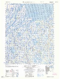
1962 · Harrison Bay B-1
USGS Topo · 1:50,000