
1955 Map of Harrison Bay B-1
USGS Topo · Published 1967About this map
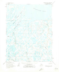
The Colville River Delta dominates this mid-century topographic study, where the expansive river system meets the waters of Harrison Bay. The landscape is defined by an intricate network of braided channels, including the Kupigruak Channel, and thousands of thaw lakes that pockmark the tundra. Landforms such as Anachlik Island and Nuekshat Island emerge within the Colville River, while names like Norma, Orion, and Nimrod identify specific locations across the flat, water-logged terrain.
Find a feature on this map
13 named features on this map. Tap any name to fly to it.
Don’t see what you’re looking for? This feature index may not catch every label — zoom into the map to look around manually.
Map Details
Editions of this 1955 Harrison Bay B-1 Map
2 editions found
Other maps of this area

1951 · Harrison Bay
USGS Topo · 1:250,000

1951 · Beechey Point
USGS Topo · 1:250,000

1955 · Harrison Bay
USGS Topo · 1:250,000

1955 · Beechey Point
USGS Topo · 1:250,000

1955 · Harrison Bay C-1
USGS Topo · 1:63,360

1955 · Harrison Bay B-2
USGS Topo · 1:63,360

1955 · Beechey Point A-5
USGS Topo · 1:63,360
1955 · Beechey Point C-5
USGS Topo · 1:63,360

1955 · Beechey Point B-5
USGS Topo · 1:63,360

1955 · Harrison Bay A-2
USGS Topo · 1:63,360