
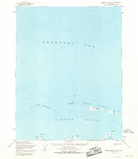
1955 Map of Harrison Bay C-1
USGS Topo · Published 1967About this map
Beaufort Sea soundings and coastal hydrography define this 1955 survey of the Alaskan North Slope. The map primarily covers the open waters of the arctic, transitioning from the deeper Beaufort Sea in the north to the shallower reaches of Harrison Bay in the south. Compiled from aerial photography and Usc&GS charts, the sheet documents the precise position of the barrier island chain known as the Jones Islands, including the prominent Thetis Island. This coastal segment represents the remote arctic shoreline before the significant industrial developments associated with later North Slope oil exploration. The lack of inland features or roads highlights the isolation of this maritime environment during the mid-1950s, focusing entirely on the interface between the icy sea and the low-lying coastal bars.
Find a feature on this map
4 named features on this map. Tap any name to fly to it.
Don’t see what you’re looking for? This feature index may not catch every label — zoom into the map to look around manually.
Map Details
Editions of this 1955 Harrison Bay C-1 Map
This is the sole edition of this map. No revisions or reprints were ever made.
Other maps of this area

1951 · Harrison Bay
USGS Topo · 1:250,000

1951 · Beechey Point
USGS Topo · 1:250,000

1955 · Harrison Bay
USGS Topo · 1:250,000

1955 · Beechey Point
USGS Topo · 1:250,000

1955 · Harrison Bay B-2
USGS Topo · 1:63,360

1955 · Harrison Bay B-1
USGS Topo · 1:63,360
1955 · Beechey Point C-5
USGS Topo · 1:63,360

1955 · Beechey Point B-5
USGS Topo · 1:63,360

1960 · Beechey Point
USGS Topo · 1:250,000
1962 · Harrison Bay B-1
USGS Topo · 1:50,000