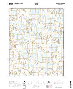
2017 Map of Beechey Point B-5 SW
USGS Topo · Published 2017About this map
The Ugnuravik River meanders across this Arctic landscape, defining the hydrology of a region dominated by countless small lakes and ponds. Located in the North Slope Borough, the terrain is characterized by its complex network of seasonal wetlands and thaw lakes typical of the coastal plain environment. The Public Land Survey System grid, including boundaries for t12n r9e and t11n r9e, provides the primary structural reference for this remote territory. This mapping reveals the intricate drainage patterns where water is the primary sculptor of the land, reflecting the environmental conditions of the early twenty-first century before significant industrial or infrastructure shifts might alter the surface hydrology.
Find a feature on this map
10 named features on this map. Tap any name to fly to it.
Don’t see what you’re looking for? This feature index may not catch every label — zoom into the map to look around manually.
Map Details
Editions of this 2017 Beechey Point B-5 SW Map
This is the sole edition of this map. No revisions or reprints were ever made.
Other maps of this area

1951 · Harrison Bay
USGS Topo · 1:250,000

1951 · Beechey Point
USGS Topo · 1:250,000

1955 · Harrison Bay
USGS Topo · 1:250,000

1955 · Beechey Point
USGS Topo · 1:250,000

1955 · Harrison Bay B-1
USGS Topo · 1:63,360

1955 · Beechey Point A-5
USGS Topo · 1:63,360

1955 · Beechey Point B-5
USGS Topo · 1:63,360
1955 · Harrison Bay A-1
USGS Topo · 1:63,360

1960 · Beechey Point
USGS Topo · 1:250,000
1962 · Harrison Bay B-1
USGS Topo · 1:50,000