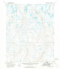
1955 Map of Harrison Bay A-1
USGS Topo · Published 1970About this map
The Miluveach River and Kachemach River define the intricate drainage patterns of this Arctic coastal plain in the mid-1950s. This land, mapped by the Army Map Service and the Geological Survey, reveals a landscape dominated by thaw lakes and low-lying wetlands typical of the North Slope. In the northeast corner, Kalubik Creek winds through the tundra toward the coast. The absence of roads or established trails throughout the quadrangle highlights the sheer isolation of this region during the mid-century era, prior to the large-scale industrial shifts that would later arrive. The survey provides a precise record of these shifting river channels and unnamed water bodies as they appeared during the 1955 field annotation, serving as a baseline for understanding the physical geography of the Harrison Bay area.
Find a feature on this map
3 named features on this map. Tap any name to fly to it.
Don’t see what you’re looking for? This feature index may not catch every label — zoom into the map to look around manually.
Map Details
Editions of this 1955 Harrison Bay A-1 Map
2 editions found
Other maps of this area

1951 · Harrison Bay
USGS Topo · 1:250,000

1951 · Beechey Point
USGS Topo · 1:250,000

1951 · Sagavanirktok D-5
USGS Topo · 1:250,000

1952 · Umiat
USGS Topo · 1:250,000

1955 · Harrison Bay
USGS Topo · 1:250,000

1955 · Beechey Point
USGS Topo · 1:250,000

1955 · Harrison Bay B-2
USGS Topo · 1:63,360

1955 · Harrison Bay B-1
USGS Topo · 1:63,360

1955 · Beechey Point A-5
USGS Topo · 1:63,360

1955 · Umiat D-2
USGS Topo · 1:63,360