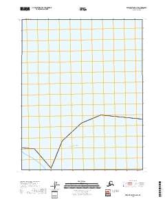
2018 Map of Beechey Point C-2 SW
USGS Topo · Published 2018About this map
Arctic Ocean waters dominate this remote coastal stretch of the North Slope, where the land and sea meet along a sparsely detailed shoreline. This 2018 survey reveals the simple intersection of the marine environment and the Rectangular Survey System, marking the boundaries of t13n r15e and t13n r16e. The map illustrates the extreme northern reaches of Alaska before the introduction of modern coastal infrastructure, providing a clean baseline for studying the shifting interface of the arctic coastline.
Find a feature on this map
3 named features on this map. Tap any name to fly to it.
Don’t see what you’re looking for? This feature index may not catch every label — zoom into the map to look around manually.
Map Details
Editions of this 2018 Beechey Point C-2 SW Map
This is the sole edition of this map. No revisions or reprints were ever made.
Other maps of this area

1951 · Beechey Point
USGS Topo · 1:250,000

1955 · Beechey Point
USGS Topo · 1:250,000

1955 · Beechey Point B-2
USGS Topo · 1:63,360

1955 · Beechey Point B-3
USGS Topo · 1:63,360

1960 · Beechey Point
USGS Topo · 1:250,000

1962 · Beechey Point B-2
USGS Topo · 1:50,000

1964 · Beechey Point
USGS Topo · 1:250,000
2017 · Beechey Point B-3 NE
USGS Topo · 1:25,000
2017 · Beechey Point B-2 NW
USGS Topo · 1:25,000
2018 · Beechey Point C-3 SE
USGS Topo · 1:25,000