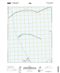
2017 Map of Beechey Point C-5 SW
USGS Topo · Published 2017About this map
Oliktok Point serves as the southern anchor for this coastal survey of the North Slope Borough shoreline. The landscape is defined by the shallow waters of Simpson Lagoon, protected from the open Beaufort Sea by a thin chain of barrier features. These include the Spy Islands and Leavitt Island, which sit at the edge of the Arctic Ocean. This map documents the complex relationship between the low-lying tundra coastline and the shifting sea during the early 21st century. The sparse distribution of named points highlights the isolation of this Arctic environment, where small landforms like islands and points provide the primary geographical markers for navigation and local history along the northern coast.
Find a feature on this map
12 named features on this map. Tap any name to fly to it.
Don’t see what you’re looking for? This feature index may not catch every label — zoom into the map to look around manually.
Map Details
Editions of this 2017 Beechey Point C-5 SW Map
This is the sole edition of this map. No revisions or reprints were ever made.
Other maps of this area

1951 · Harrison Bay
USGS Topo · 1:250,000

1951 · Beechey Point
USGS Topo · 1:250,000

1955 · Harrison Bay
USGS Topo · 1:250,000

1955 · Beechey Point
USGS Topo · 1:250,000

1955 · Harrison Bay C-1
USGS Topo · 1:63,360

1955 · Harrison Bay B-1
USGS Topo · 1:63,360
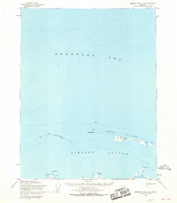
1955 · Beechey Point C-5
USGS Topo · 1:63,360

1955 · Beechey Point B-5
USGS Topo · 1:63,360

1960 · Beechey Point
USGS Topo · 1:250,000
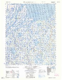
1962 · Harrison Bay B-1
USGS Topo · 1:50,000