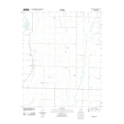
2011 Map of Beedeville
USGS Topo · Published 2011About this map
Beedeville and McFadden anchor this landscape in Jackson County, where the agricultural grid meets the winding waters of Bayou De View. The map illustrates a region defined by its drainage and irrigation network, featuring systems like the May Branch Lateral and Threemile Creek that support the surrounding farmlands. This 2011 survey is particularly valuable for genealogists, as it meticulously identifies several local burial sites, including Eight Mile Cemetery, Walker Cemetery, Dale Cemetery, Jones Cemetery, and Givens Cemetery. The eastern portion of the sheet is characterized by the complex hydrology of Old Forked Slough and several unnamed water bodies, while the western edge is bounded by the Cache River. A dense network of local roads, such as Grindstone Ridge Rd and Ben Dawson Rd, connects these rural communities and family landmarks, providing a clear picture of the modern road system imposed over the traditional Delta landscape.
Find a feature on this map
49 named features on this map. Tap any name to fly to it.
Don’t see what you’re looking for? This feature index may not catch every label — zoom into the map to look around manually.
Map Details
Editions of this 2011 Beedeville Map
This is the sole edition of this map. No revisions or reprints were ever made.
Other maps of this area

1935 · Tuckerman
USGS Topo · 1:62,500

1939 · Vanndale
USGS Topo · 1:62,500

1939 · Weiner
USGS Topo · 1:62,500

1940 · Tilton
USGS Topo · 1:62,500

1953 · Memphis
USGS Topo · 1:250,000

1956 · Memphis
USGS Topo · 1:250,000

1956 · Tilton
USGS Topo · 1:62,500

1958 · Vanndale
USGS Topo · 1:62,500

1959 · Weiner
USGS Topo · 1:62,500

1960 · Weiner
USGS Topo · 1:62,500