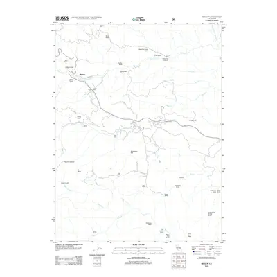
2012 Map of Beegum
USGS Topo · Published 2012About this map
Beegum sits at the junction of Beegum Rd and Tedoc Rd, serving as a central point in this landscape of cattle ranches and gulches in Shasta County. The map details a legacy of land ownership through numerous named homesteads, including the Williams Ranch in the north and the Foss Ranch further south. These sites are linked by local tracks like Sunnybrook Ln and Ball Rd, tracing the movement of people and livestock through the foothills. Water sources are critical to the character of the terrain, with Beegum Cr and the Middle Fork Cottonwood Cr cutting through the hills. From the heights of Patty Mocus Butte to the depths of Goldsborough Gulch, the map captures a rural California environment defined by its drainage basins and isolated ranching outposts.
Find a feature on this map
55 named features on this map. Tap any name to fly to it.
Don’t see what you’re looking for? This feature index may not catch every label — zoom into the map to look around manually.
Map Details
Editions of this 2012 Beegum Map
This is the sole edition of this map. No revisions or reprints were ever made.
Other maps of this area

1890 · Red Bluff
USGS Topo · 1:250,000

1894 · Red Bluff
USGS Topo · 1:250,000

1949 · Colyear Springs
USGS Topo · 1:62,500

1951 · Chanchelulla Peak
USGS Topo · 1:62,500

1952 · Ono
USGS Topo · 1:62,500

1954 · Yolla Bolly
USGS Topo · 1:62,500

1957 · Colyear Springs
USGS Topo · 1:62,500

1958 · Redding
USGS Topo · 1:250,000
1967 · Cold Fork
USGS Topo · 1:24,000
1979 · Red Bluff
USGS Topo · 1:100,000