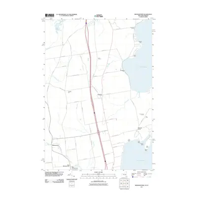
2011 Map of Beekmantown
USGS Topo · Published 2011About this map
Lake Champlain dominates the eastern edge of this Clinton County landscape, defining a shoreline marked by numerous points and bays such as Savage Point and Wool Point. This coastal orientation is balanced by an inland network of small waterways including Dead Creek, Riley Brook, and the Little Chazy River. The interior reflects a mix of small hamlets and agricultural tradition, centered around the primary settlements of Beekmantown, East Beekmantown, and Ingraham. The mapping of several small burial grounds, including the Doane Cemetery and Trombley Bay Cemetery, provides vital points of reference for genealogists tracking families in the area north of Plattsburgh. Public recreation areas like Saint Armand Beach near Middle Point illustrate the region's enduring connection to the water, while the presence of Stratton Hill offers a rare elevation point in the relatively low-lying terrain near the lake.
Find a feature on this map
56 named features on this map. Tap any name to fly to it.
Don’t see what you’re looking for? This feature index may not catch every label — zoom into the map to look around manually.
Map Details
Editions of this 2011 Beekmantown Map
This is the sole edition of this map. No revisions or reprints were ever made.
Other maps of this area

1894 · Plattsburg
USGS Topo · 1:62,500

1895 · Mooers
USGS Topo · 1:62,500

1895 · Rouse Point
USGS Topo · 1:62,500

1899 · Mooers
USGS Topo · 1:62,500

1906 · Plattsburg
USGS Topo · 1:62,500

1907 · Rouse Point
USGS Topo · 1:62,500

1913 · Dannemora
USGS Topo · 1:62,500

1939 · Rouses Point
USGS Topo · 1:62,500

1939 · Plattsburg
USGS Topo · 1:62,500

1941 · Plattsburg
USGS Topo · 1:62,500