
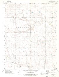
1965 Map of Beeler
USGS Topo · Published 1967About this map
The small unincorporated community of Beeler sits at the heart of this mid-1960s survey, marking a vital junction between the Atchison Topeka and Santa Fe railroad and the winding course of South Fork Walnut Creek. This western Kansas landscape is defined by the sharp contrast between the upland prairie plains and the intricate drainage networks of Walnut Creek, Darr Creek, and Spring Creek.
Find a feature on this map
16 named features on this map. Tap any name to fly to it.
Don’t see what you’re looking for? This feature index may not catch every label — zoom into the map to look around manually.
Map Details
Editions of this 1965 Beeler Map
This is the sole edition of this map. No revisions or reprints were ever made.
Other maps of this area

1955 · Scott City
USGS Topo · 1:250,000

1958 · Scott City
USGS Topo · 1:250,000

1965 · Utica SW
USGS Topo · 1:24,000

1966 · Laird
USGS Topo · 1:24,000

1966 · Utica SE
USGS Topo · 1:24,000
1974 · Beeler SE
USGS Topo · 1:24,000

1974 · Alamota
USGS Topo · 1:24,000

1974 · Beeler SW
USGS Topo · 1:24,000

1974 · Dighton SE
USGS Topo · 1:24,000

1974 · Shields SE
USGS Topo · 1:24,000