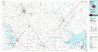
1985 Map of Beeville
USGS Topo · Published 1985About this map
Chase Field Naval Air Station stands as a significant military installation within this South Texas landscape, situated just east of the bustling hub of Beeville. The map illustrates a region defined by its transition from inland agricultural plains to the intricate coastal wetlands of Copano Bay. Essential transit corridors including the Southern Pacific and Missouri Pacific railroads connect established settlements like Skidmore, Sinton, and Refugio, tracing the historical paths of commerce through Bee and San Patricio counties.
Find a feature on this map
72 named features on this map. Tap any name to fly to it.
Don’t see what you’re looking for? This feature index may not catch every label — zoom into the map to look around manually.
Map Details
Editions of this 1985 Beeville Map
2 editions found
Other maps of this area

1920 · Mikeska
USGS Topo · 1:125,000

1920 · San Diego
USGS Topo · 1:62,500

1925 · Oakville No. 4
USGS Topo · 1:48,000

1925 · Mathis No. 2
USGS Topo · 1:48,000

1925 · Robstown
USGS Topo · 1:62,500

1925 · Aransas Pass
USGS Topo · 1:62,500

1925 · Mathis No. 3
USGS Topo · 1:48,000

1925 · Corpus Christi
USGS Topo · 1:62,500

1927 · Mathis
USGS Topo · 1:62,500

1927 · Oakville
USGS Topo · 1:62,500