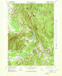
1964 Map of Belchertown
USGS Topo · Published 1979About this map
The Holyoke Range and its eastern slopes define the landscape of this mid-century survey, where the town of Belchertown serves as a central hub for the surrounding rural economy. The map illustrates a complex network of institutional and natural features, most notably the large Belchertown State School and the St Hyacinths Seminary and College near Forge Pond. Transportation is a key theme, with the Boston and Maine and Central Vermont railroads navigating the area's many brooks and swamps, such as the expansive Lawrence Swamp.
Find a feature on this map
74 named features on this map. Tap any name to fly to it.
Don’t see what you’re looking for? This feature index may not catch every label — zoom into the map to look around manually.
Map Details
Editions of this 1964 Belchertown Map
3 editions found
Other maps of this area

1885 · Northampton
USGS Topo · 1:62,500

1886 · Springfield
USGS Topo · 1:62,500

1886 · Northampton
USGS Topo · 1:62,500

1887 · Palmer
USGS Topo · 1:62,500

1887 · Belchertown
USGS Topo · 1:62,500

1889 · Springfield
USGS Topo · 1:62,500

1889 · Palmer
USGS Topo · 1:62,500

1890 · Belchertown
USGS Topo · 1:62,500

1891 · Northampton
USGS Topo · 1:62,500

1893 · Northampton
USGS Topo · 1:62,500