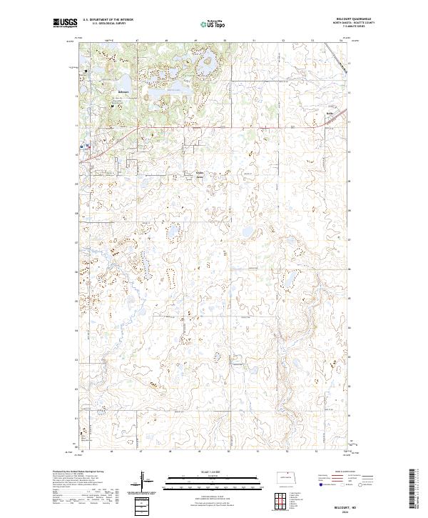
2024 Map of Belcourt
USGS Topo · Published 2024About this map
Turtle Mountains topography and seasonal wetlands define this section of Rolette County, characterized by a complex network of glacial potholes and small lakes. The community of Belcourt is a focal point of the area, situated near the An-Qui-Ni Gay Indian Burial Ground. This modern survey illustrates the current balance between residential development, such as Green Acres, and vast conservation efforts within the Rolette County Waterfowl Production Area. Local history is anchored by sites like Saint Paul Cem in the northwest and Saint Marys Maryville Cem in the southwest. Transport and accessibility are shown through a dense grid of Bureau of Indian Affairs roads, including Bia RD 7 and Bia RD 10, which connect these small settlements and agricultural tracts to the nearby city of Rolla.
Find a feature on this map
38 named features on this map. Tap any name to fly to it.
Don’t see what you’re looking for? This feature index may not catch every label — zoom into the map to look around manually.
Map Details
Editions of this 2024 Belcourt Map
This is the sole edition of this map. No revisions or reprints were ever made.
Other maps of this area

1936 · Lake Upsilon
USGS Topo · 1:48,000

1942 · Lake Upsilon
USGS Topo · 1:62,500

1953 · Devils Lake
USGS Topo · 1:250,000

1956 · Devils Lake
USGS Topo · 1:250,000

1968 · Lake Upsilon SE
USGS Topo · 1:24,000
1968 · Lake Upsilon
USGS Topo · 1:24,000

1968 · Belcourt
USGS Topo · 1:24,000

1969 · Saint John
USGS Topo · 1:24,000

1969 · Rolla NE
USGS Topo · 1:24,000

1970 · Rolla
USGS Topo · 1:24,000