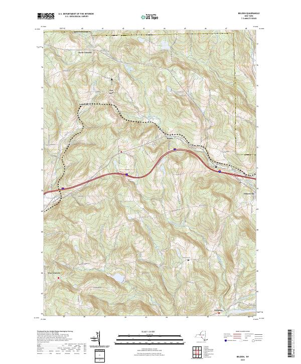
2023 Map of Belden
USGS Topo · Published 2023About this map
North Colesville and the surrounding hamlets of eastern Broome County are defined by the winding drainages of the Susquehanna River watershed. The landscape is marked by a network of rural routes like Farm to Market Rd and Death Valley Rd that connect high-elevation ridges with the fertile bottomlands of Still Creek and Ouaquaga Creek. The presence of small community centers such as New Ohio and Tunnel reflects the historical pattern of agricultural settlement in these upland valleys. Genealogists can find important local records at New Ohio Cem, Coles Hill Cem, and Pratt Cem, which remain as cornerstones of the area's rural heritage. This modern survey tracks how the topography continues to shape development, from the course of the Belden Brook to the placement of crossroads in Harpursville and West Colesville.
Find a feature on this map
51 named features on this map. Tap any name to fly to it.
Don’t see what you’re looking for? This feature index may not catch every label — zoom into the map to look around manually.
Map Details
Editions of this 2023 Belden Map
This is the sole edition of this map. No revisions or reprints were ever made.
Other maps of this area

1902 · Coventry
USGS Topo · 1:62,500

1904 · Binghamton
USGS Topo · 1:62,500

1904 · Greene
USGS Topo · 1:62,500

1904 · Oxford
USGS Topo · 1:62,500

1905 · Nineveh
USGS Topo · 1:62,500

1935 · Chenango Forks
USGS Topo · 1:24,000

1937 · Binghamton East
USGS Topo · 1:24,000

1942 · Chenango Forks
USGS Topo · 1:31,680

1942 · Binghamton East
USGS Topo · 1:31,680
1948 · Greene
USGS Topo · 1:24,000