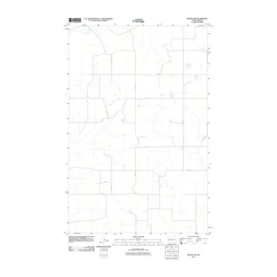
2011 Map of Belden SW
USGS Topo · Published 2011About this map
The Little Knife River winds through this rural section of Mountrail County, serving as the primary natural landmark in a landscape defined by its strict rectangular grid of section lines and gravel roads. This survey, compiled from imagery and data between 2008 and 2010, shows the deep rural character of the North Dakota plains northwest of New Town. The terrain is organized by a systematic network of thoroughfares, including north-south corridors like 85th Ave NW and 84th Ave NW, which intersect with east-west routes such as 47th St NW and 43rd St NW. This layout reveals the enduring influence of the Public Land Survey System on modern infrastructure, where local travel remains tied to the precise lines established by early prairie settlement and farming boundaries.
Find a feature on this map
12 named features on this map. Tap any name to fly to it.
Don’t see what you’re looking for? This feature index may not catch every label — zoom into the map to look around manually.
Map Details
Editions of this 2011 Belden SW Map
This is the sole edition of this map. No revisions or reprints were ever made.
Other maps of this area

1953 · Williston
USGS Topo · 1:250,000

1953 · Watford City
USGS Topo · 1:250,000

1957 · Williston
USGS Topo · 1:250,000

1957 · Watford City
USGS Topo · 1:250,000

1967 · Watford City
USGS Topo · 1:250,000

1967 · Sanish
USGS Topo · 1:24,000

1981 · Belden SW
USGS Topo · 1:24,000

1981 · Robinson Lake
USGS Topo · 1:24,000

1981 · New Town
USGS Topo · 1:24,000
1981 · Rat Lake SE
USGS Topo · 1:24,000