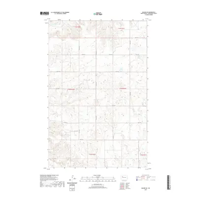
2020 Map of Belden SW
USGS Topo · Published 2020About this map
Little Knife River winds through the northwestern corner of this territory, carving a drainage pattern into the rolling prairie of Mountrail County. This landscape is defined by the rigid grid of the Public Land Survey System, where section lines are traced by local roads such as 48th St NW and 82nd Ave NW. The terrain is characterized by numerous small depressions and kettle ponds, typical of the glaciated plains, which scatter across the townships of T153N and T154N. While the area remains predominantly open and rural, the network of gravel roads like 85th Ave NW and 43rd St NW provides access to this remote portion of the North Dakota oil patch, illustrating the intersection of traditional agricultural land divisions with modern infrastructure.
Find a feature on this map
21 named features on this map. Tap any name to fly to it.
Don’t see what you’re looking for? This feature index may not catch every label — zoom into the map to look around manually.
Map Details
Editions of this 2020 Belden SW Map
This is the sole edition of this map. No revisions or reprints were ever made.
Other maps of this area

1953 · Williston
USGS Topo · 1:250,000

1953 · Watford City
USGS Topo · 1:250,000

1957 · Williston
USGS Topo · 1:250,000

1957 · Watford City
USGS Topo · 1:250,000

1967 · Watford City
USGS Topo · 1:250,000

1967 · Sanish
USGS Topo · 1:24,000

1981 · Belden SW
USGS Topo · 1:24,000

1981 · Robinson Lake
USGS Topo · 1:24,000

1981 · New Town
USGS Topo · 1:24,000
1981 · Rat Lake SE
USGS Topo · 1:24,000