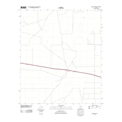
2010 Map of Belding NW
USGS Topo · Published 2010About this map
This Pecos County landscape is defined by the rigid geometry of the West Texas road network and its intersection with modern infrastructure. Surveyed in 2010, the quadrangle highlights a transportation hub where north-south routes like Kennedy Rd and Braden Rd traverse the arid terrain. The map captures the significant interchange of a divided highway that cuts across the central portion of the sheet, reflecting the area's role as a transit corridor. Local access routes, including Riley Rd, connect the scattered infrastructure that punctuates this expansive region. The mapping demonstrates the modern footprint of Texas ranch and highway development, providing a clear record of the area's physical layout before further expansion or landscape changes.
Find a feature on this map
3 named features on this map. Tap any name to fly to it.
Don’t see what you’re looking for? This feature index may not catch every label — zoom into the map to look around manually.
Map Details
Editions of this 2010 Belding NW Map
This is the sole edition of this map. No revisions or reprints were ever made.
Other maps of this area

1929 · Hovey
USGS Topo · 1:125,000

1931 · Barstow
USGS Topo · 1:125,000

1954 · Pecos
USGS Topo · 1:250,000

1954 · Fort Stockton
USGS Topo · 1:250,000

1957 · Pecos
USGS Topo · 1:250,000

1958 · Fort Stockton
USGS Topo · 1:250,000

1970 · Belding SW
USGS Topo · 1:24,000

1970 · Tucker Hill
USGS Topo · 1:24,000

1970 · Deep Well Ranch SE
USGS Topo · 1:24,000

1970 · Belding NW
USGS Topo · 1:24,000