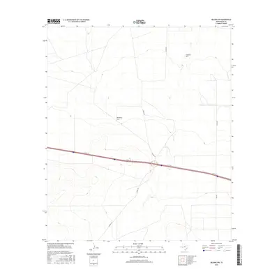
2016 Map of Belding NW
USGS Topo · Published 2016About this map
Coyanosa Draw and Hackberry Draw carve through this West Texas landscape, showing the drainage patterns of Pecos County as documented in 2016. The map illustrates a transition between open terrain and a developing transportation corridor, where the modern interstate system is supported by local thoroughfares like Kennedy Rd and Braden Rd. This geography highlights the significance of seasonal watercourses in an arid environment, where intermittent draws serve as primary landmarks for navigation. Local history and genealogy researchers can trace land use and road development through the placement of Riley Rd and the I10 Svc Rd, reflecting the infrastructure that connects these remote Texas coordinates.
Find a feature on this map
6 named features on this map. Tap any name to fly to it.
Don’t see what you’re looking for? This feature index may not catch every label — zoom into the map to look around manually.
Map Details
Editions of this 2016 Belding NW Map
This is the sole edition of this map. No revisions or reprints were ever made.
Other maps of this area

1929 · Hovey
USGS Topo · 1:125,000

1931 · Barstow
USGS Topo · 1:125,000

1954 · Pecos
USGS Topo · 1:250,000

1954 · Fort Stockton
USGS Topo · 1:250,000

1957 · Pecos
USGS Topo · 1:250,000

1958 · Fort Stockton
USGS Topo · 1:250,000

1970 · Belding SW
USGS Topo · 1:24,000

1970 · Tucker Hill
USGS Topo · 1:24,000

1970 · Deep Well Ranch SE
USGS Topo · 1:24,000

1970 · Belding NW
USGS Topo · 1:24,000