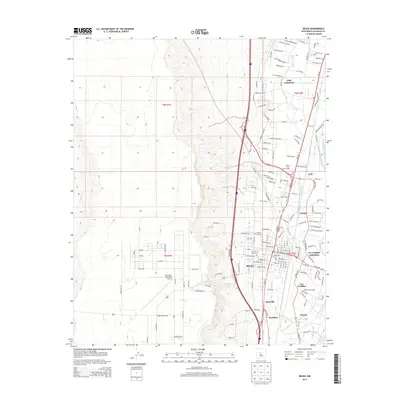
2013 Map of Belen
USGS Topo · Published 2013About this map
The Rio Grande and its intricate network of irrigation ditches and drains define the agricultural and residential character of this Middle Rio Grande Valley landscape. The central hub of Belen is surrounded by a dense cluster of communities including Sausal, Los Trujillos-Gabaldon, and Bacaville. The valley's reliance on water management is evident in the numerous engineering works such as the Belen Highline Canal, Garcia-Lateral Number 1, and the Sausal Drain.
Find a feature on this map
101 named features on this map. Tap any name to fly to it.
Don’t see what you’re looking for? This feature index may not catch every label — zoom into the map to look around manually.
Map Details
Editions of this 2013 Belen Map
This is the sole edition of this map. No revisions or reprints were ever made.
Other maps of this area

1952 · Dalies
USGS Topo · 1:24,000

1952 · Belen SW
USGS Topo · 1:24,000

1952 · Belen
USGS Topo · 1:24,000

1952 · Turn
USGS Topo · 1:24,000

1952 · Veguita
USGS Topo · 1:24,000

1952 · Belen NW
USGS Topo · 1:24,000

1952 · Rio Puerco
USGS Topo · 1:24,000

1952 · Tome
USGS Topo · 1:24,000

1952 · Los Lunas
USGS Topo · 1:24,000

1954 · Socorro
USGS Topo · 1:250,000