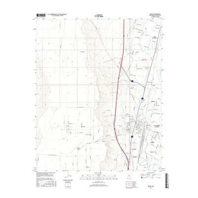
2017 Map of Belen
USGS Topo · Published 2017About this map
The Rio Grande corridor serves as the central artery for this 2017 survey of Valencia County, where a complex network of irrigation and drainage infrastructure dictates the settlement pattern. From the Belen Highline Canal to the Old Belen Ditch, these water systems support a string of communities including Los Chaves, Sausal, and Los Trujillos-Gabaldon. The town of Belen serves as the primary hub, anchored by its proximity to the river and established landmarks like Our Lady of Belen Cem and the Alexander Municipal Airport. To the west, the terrain rises sharply toward Sunrise Bluff, while the eastern flats are characterized by a dense grid of named rural roads and laterals. Genealogists will find particular value in the clearly marked cemeteries and the distinct boundaries between local neighborhoods such as Bacaville, Pueblitos, and Jarales, which preserve the traditional land-use patterns of the Middle Rio Grande Valley.
Find a feature on this map
106 named features on this map. Tap any name to fly to it.
Don’t see what you’re looking for? This feature index may not catch every label — zoom into the map to look around manually.
Map Details
Editions of this 2017 Belen Map
This is the sole edition of this map. No revisions or reprints were ever made.
Other maps of this area

1952 · Dalies
USGS Topo · 1:24,000

1952 · Belen SW
USGS Topo · 1:24,000

1952 · Belen
USGS Topo · 1:24,000

1952 · Turn
USGS Topo · 1:24,000

1952 · Veguita
USGS Topo · 1:24,000

1952 · Belen NW
USGS Topo · 1:24,000

1952 · Rio Puerco
USGS Topo · 1:24,000

1952 · Tome
USGS Topo · 1:24,000

1952 · Los Lunas
USGS Topo · 1:24,000

1954 · Socorro
USGS Topo · 1:250,000