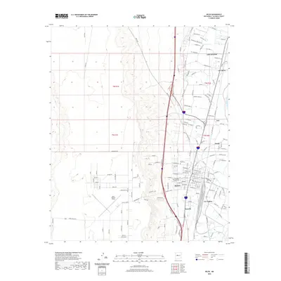
2020 Map of Belen
USGS Topo · Published 2020About this map
The Rio Grande corridor serves as the central anchor for this part of Valencia County, where the city of Belen sits at the heart of a complex network of agricultural and residential development. This modern survey illustrates the dense concentration of community landmarks, including Terrace Grove Cem and Our Lady of Belen Memorial Gardens Cem, which stand near the historic core. Beyond the city center, the landscape transitions into established settlements like Los Chaves, Los Trujillos, and Bacaville, reflecting the long-standing habitation patterns of the Rio Grande Valley. To the west, the flat mesa land is marked by the Belen Regional Airport and the distinct rise of Sunrise Bluff, while the intricate grid of local roads like Joe Sanchez Rd and Campbell Farms Rd connects the rural outskirts to the urban center.
Find a feature on this map
93 named features on this map. Tap any name to fly to it.
Don’t see what you’re looking for? This feature index may not catch every label — zoom into the map to look around manually.
Map Details
Editions of this 2020 Belen Map
This is the sole edition of this map. No revisions or reprints were ever made.
Other maps of this area

1952 · Dalies
USGS Topo · 1:24,000

1952 · Belen SW
USGS Topo · 1:24,000

1952 · Belen
USGS Topo · 1:24,000

1952 · Turn
USGS Topo · 1:24,000

1952 · Veguita
USGS Topo · 1:24,000

1952 · Belen NW
USGS Topo · 1:24,000

1952 · Rio Puerco
USGS Topo · 1:24,000

1952 · Tome
USGS Topo · 1:24,000

1952 · Los Lunas
USGS Topo · 1:24,000

1954 · Socorro
USGS Topo · 1:250,000