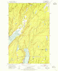
1953 Map of Belfair
USGS Topo · Published 1955About this map
The timbered hills and deep inlets of Mason and Kitsap Counties define this mid-century landscape at the head of Hood Canal. Settlement is concentrated around the established community of Belfair, where the Union River meets the mudflats of Lynch Cove. The infrastructure of the era is clearly marked, including the Northern Pacific railroad line and the Old Navy Yard Highway, which supported the regional connection to Bremerton.
Find a feature on this map
35 named features on this map. Tap any name to fly to it.
Don’t see what you’re looking for? This feature index may not catch every label — zoom into the map to look around manually.
Map Details
Editions of this 1953 Belfair Map
4 editions found
Other maps of this area

1936 · Point Misery
USGS Topo · 1:62,500

1937 · Port Orchard
USGS Topo · 1:62,500

1938 · Allyn
USGS Topo · 1:62,500

1940 · Point Misery
USGS Topo · 1:62,500

1942 · Gig Harbor
USGS Topo · 1:62,500

1943 · Gig Harbor
USGS Topo · 1:62,500

1953 · Burley
USGS Topo · 1:24,000

1953 · Sylvan
USGS Topo · 1:24,000

1953 · Vaughn
USGS Topo · 1:24,000

1953 · Bremerton West
USGS Topo · 1:24,000