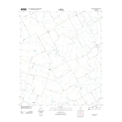
2012 Map of Belfalls
USGS Topo · Published 2012About this map
Belfalls and Blevins sit at the center of this rural Falls County landscape, characterized by a complex network of small creek drainages and agricultural land. The terrain is defined by the winding paths of Pond Creek, Indian Grave Creek, and Hoolia Creek, which dictate the placement of county roads and early homesteads. To the south, Oenaville lies near the confluence of Big Elm Creek and Pecan Creek, illustrating how early settlements followed the fertile bottoms of the Texas blackland prairies.
Find a feature on this map
65 named features on this map. Tap any name to fly to it.
Don’t see what you’re looking for? This feature index may not catch every label — zoom into the map to look around manually.
Map Details
Editions of this 2012 Belfalls Map
This is the sole edition of this map. No revisions or reprints were ever made.
Other maps of this area

1892 · Temple
USGS Topo · 1:125,000

1931 · Mc Gregor
USGS Topo · 1:62,500

1931 · Belton
USGS Topo · 1:62,500

1954 · Waco
USGS Topo · 1:250,000

1955 · Waco
USGS Topo · 1:250,000

1957 · Bruceville
USGS Topo · 1:24,000

1957 · Chilton
USGS Topo · 1:24,000
1963 · Westphalia
USGS Topo · 1:24,000
1963 · Seaton
USGS Topo · 1:24,000
1963 · Lott
USGS Topo · 1:24,000