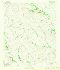
1963 Map of Westphalia
USGS Topo · Published 1965About this map
Westphalia anchors the northwestern corner of this Central Texas landscape, situated at the boundary where Falls County and Bell County meet. During the early 1960s, the area maintained a rural, agricultural character defined by small farming communities and their associated spiritual and social centers. The map documents numerous local landmarks, including the St Marys Cem and Salem Ch, as well as the small crossroads of Barclay and Zipperlandville.
Find a feature on this map
27 named features on this map. Tap any name to fly to it.
Don’t see what you’re looking for? This feature index may not catch every label — zoom into the map to look around manually.
Map Details
Editions of this 1963 Westphalia Map
2 editions found
Other maps of this area

1885 · Taylor
USGS Topo · 1:125,000

1887 · Taylor
USGS Topo · 1:125,000

1892 · Temple
USGS Topo · 1:125,000

1894 · Taylor
USGS Topo · 1:125,000

1954 · Waco
USGS Topo · 1:250,000

1954 · Austin
USGS Topo · 1:250,000

1955 · Waco
USGS Topo · 1:250,000

1962 · Rosebud
USGS Topo · 1:24,000
1962 · Ben Arnold
USGS Topo · 1:24,000

1962 · Cedar Springs
USGS Topo · 1:24,000