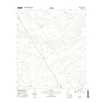
2016 Map of Belfalls
USGS Topo · Published 2016About this map
The boundary between Falls and Bell counties is defined by a landscape of creeks and small farming settlements. Centrally located, Belfalls serves as a crossroads, surrounded by other small communities like Blevins to the north and Oenaville in the south. The drainage network is complex, featuring several named tributaries including Hoolia Cr, Indian Grave Cr, and Deer Cr, which carve through the agricultural fields and ranch land.
Find a feature on this map
65 named features on this map. Tap any name to fly to it.
Don’t see what you’re looking for? This feature index may not catch every label — zoom into the map to look around manually.
Map Details
Editions of this 2016 Belfalls Map
This is the sole edition of this map. No revisions or reprints were ever made.
Other maps of this area

1892 · Temple
USGS Topo · 1:125,000

1931 · Mc Gregor
USGS Topo · 1:62,500

1931 · Belton
USGS Topo · 1:62,500

1954 · Waco
USGS Topo · 1:250,000

1955 · Waco
USGS Topo · 1:250,000

1957 · Bruceville
USGS Topo · 1:24,000

1957 · Chilton
USGS Topo · 1:24,000
1963 · Westphalia
USGS Topo · 1:24,000
1963 · Seaton
USGS Topo · 1:24,000
1963 · Lott
USGS Topo · 1:24,000