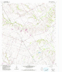
1963 Map of Belfalls
USGS Topo · Published 1993About this map
Belfalls and its surrounding rural landscapes are captured here along the dividing line between Falls Co Bell Co. This region is defined by a dendritic network of seasonal waterways, including Indian Creek, Hoolia Creek, and the wandering Deer Creek, which drain the varied topography. Small settlements like Blevins, Cego, and Durango are linked by thoroughfares such as Old Blevins Road, reflecting a mid-century agricultural community structure. Several small burial grounds, including Lena Cem and Theo Cem, are scattered throughout the countryside, providing essential points of interest for genealogical research. Revisions made in the 1990s are layered over the original 1960s survey, highlighting subtle changes in land use and the path of a major Pipeline cutting across the central hills.
Find a feature on this map
23 named features on this map. Tap any name to fly to it.
Don’t see what you’re looking for? This feature index may not catch every label — zoom into the map to look around manually.
Map Details
Editions of this 1963 Belfalls Map
This is the sole edition of this map. No revisions or reprints were ever made.
Other maps of this area

1892 · Temple
USGS Topo · 1:125,000

1931 · Mc Gregor
USGS Topo · 1:62,500

1931 · Belton
USGS Topo · 1:62,500

1954 · Waco
USGS Topo · 1:250,000

1955 · Waco
USGS Topo · 1:250,000

1957 · Bruceville
USGS Topo · 1:24,000

1957 · Chilton
USGS Topo · 1:24,000
1963 · Westphalia
USGS Topo · 1:24,000
1963 · Seaton
USGS Topo · 1:24,000
1963 · Lott
USGS Topo · 1:24,000