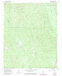
1964 Map of Belfast
USGS Topo · Published 1984About this map
Belfast sits at the heart of this landscape where the boundaries of Saline and Grant counties meet, documented during a mid-1960s survey with updates reflecting early 1980s changes. The community is anchored by local landmarks such as Mars Hill Ch and Palestine Ch, which served the rural population gathered around the crossroads and creek bottoms. The geography is defined by a dense network of watercourses including Hurricane Creek and Bazley Creek, alongside smaller drainages like Skullbone Creek and Little Lost Creek.
Find a feature on this map
30 named features on this map. Tap any name to fly to it.
Don’t see what you’re looking for? This feature index may not catch every label — zoom into the map to look around manually.
Map Details
Editions of this 1964 Belfast Map
4 editions found

Other maps of this area

1890 · Benton
USGS Topo · 1:125,000

1891 · Little Rock
USGS Topo · 1:125,000

1893 · Little Rock
USGS Topo · 1:125,000

1894 · Benton
USGS Topo · 1:125,000

1935 · Alexander
USGS Topo · 1:48,000

1938 · Benton
USGS Topo · 1:48,000

1941 · Alexander
USGS Topo · 1:62,500

1944 · Benton
USGS Topo · 1:62,500

1944 · Spring Lake
USGS Topo · 1:31,680

1944 · Bryant
USGS Topo · 1:31,680