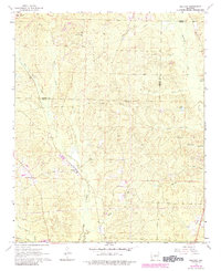
1964 Map of Belfast
USGS Topo · Published 1984About this map
Belfast serves as a central point of interest in this Arkansas survey, situated near the boundary where Saline and Grant Counties meet. The landscape is defined by a dense network of tributaries including Wet Lost Creek, Hurricane Creek, and the curiously named Skullbone Creek. Small centers of rural life are scattered throughout the hills, marked primarily by country churches and cemeteries. Mars Hill Ch stands to the north, while Palestine Ch and Corinth Ch anchor the southern reaches of the quadrangle. Local industry and infrastructure are represented by several Gravel Pits and two prominent pipeline corridors that traverse the terrain, alongside family-named landmarks like Lake Kay and Beard Branch. This edition includes updates from the early 1980s, revealing later woodland expansion over the original 1960s topographic base.
Find a feature on this map
24 named features on this map. Tap any name to fly to it.
Don’t see what you’re looking for? This feature index may not catch every label — zoom into the map to look around manually.
Map Details
Editions of this 1964 Belfast Map
4 editions found

Other maps of this area

1890 · Benton
USGS Topo · 1:125,000

1891 · Little Rock
USGS Topo · 1:125,000

1893 · Little Rock
USGS Topo · 1:125,000

1894 · Benton
USGS Topo · 1:125,000

1935 · Alexander
USGS Topo · 1:48,000

1938 · Benton
USGS Topo · 1:48,000

1941 · Alexander
USGS Topo · 1:62,500

1944 · Benton
USGS Topo · 1:62,500

1944 · Spring Lake
USGS Topo · 1:31,680

1944 · Bryant
USGS Topo · 1:31,680