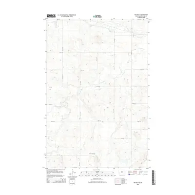
2014 Map of Belfield SE
USGS Topo · Published 2014About this map
Little Badlands define the southern reaches of this landscape in Stark County, where the erosion-carved terrain drops toward the drainage basins of the Missouri River watershed. This region is dominated by the intricate branching of the Heart River, which flows across the northern section of the map, while the S Br Heart River and its tributaries like Bull Cr and Norwegian Cr snake through the central and western coulees. The map illustrates a highly organized grid of rural infrastructure, where gravel roads like 124th Ave SW and 42nd St SW follow section lines across the high plains. This layout reveals the persistent influence of the Public Land Survey System on the contemporary North Dakota ranching and farming landscape, showing how modern access routes remain bound to historical property boundaries even in the complex topography of the badlands.
Find a feature on this map
19 named features on this map. Tap any name to fly to it.
Don’t see what you’re looking for? This feature index may not catch every label — zoom into the map to look around manually.
Map Details
Editions of this 2014 Belfield SE Map
This is the sole edition of this map. No revisions or reprints were ever made.
Other maps of this area

1953 · Dickinson
USGS Topo · 1:250,000

1957 · Dickinson
USGS Topo · 1:250,000

1961 · Daglum
USGS Topo · 1:62,500

1962 · Belfield NE
USGS Topo · 1:24,000

1962 · Belfield SW
USGS Topo · 1:24,000

1962 · Belfield
USGS Topo · 1:24,000

1962 · Belfield SE
USGS Topo · 1:24,000

1973 · New Hradec South
USGS Topo · 1:24,000

1973 · New England NW
USGS Topo · 1:24,000
1973 · South Heart
USGS Topo · 1:24,000