
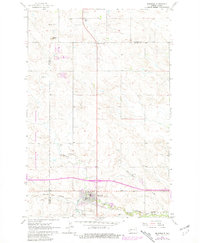
1962 Map of Belfield
USGS Topo · Published 1964About this map
Belfield stands at the intersection of industry and prairie along the Northern Pacific railroad in the early 1960s. This survey illustrates a landscape undergoing modernization, notably marked by a long stretch of Proposed roadway cutting across the terrain north of the main settlement. The town itself is well-defined by its proximity to the Heart River and Coal Creek, which provide the primary drainage for this portion of the Billings and Stark County border. Cultural and community landmarks like St Stanislaus Cem and Truelson Sch offer specific points of interest for genealogists tracing local families. The presence of numerous Scoria Pits and various Mines throughout the area, including sites near Six Mile Corner, underscores the region's reliance on geological resources during this era.
Find a feature on this map
16 named features on this map. Tap any name to fly to it.
Don’t see what you’re looking for? This feature index may not catch every label — zoom into the map to look around manually.
Map Details
Editions of this 1962 Belfield Map
2 editions found
Other maps of this area

1953 · Dickinson
USGS Topo · 1:250,000

1953 · Watford City
USGS Topo · 1:250,000

1957 · Dickinson
USGS Topo · 1:250,000

1957 · Watford City
USGS Topo · 1:250,000

1962 · Fryburg NE
USGS Topo · 1:24,000

1962 · Belfield NE
USGS Topo · 1:24,000

1962 · Belfield SW
USGS Topo · 1:24,000

1962 · Fryburg
USGS Topo · 1:24,000

1962 · Belfield SE
USGS Topo · 1:24,000

1963 · Fairfield SE
USGS Topo · 1:24,000