
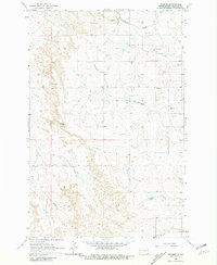
1962 Map of Fryburg
USGS Topo · Published 1964About this map
Fryburg stands as the primary settlement in this corner of Billings County, situated at the intersection of a local road network and the Northern Pacific railroad line. The early 1960s landscape is defined by the industrial footprint of the Fryburg Oil Field, which occupies the high ground north of the tracks. This industrial activity is mirrored by numerous Scoria Pits and a Mine scattered across the undulating terrain. Drainage for the region is provided by the winding courses of Norwegian Creek and Davis Creek, which carve through the topography alongside isolated water sources like a named Spring and Well. The map illustrates a transitional period in western North Dakota, where traditional cattle-country ranching and transport infrastructure were increasingly overlaid by the development of the Williston Basin oil industry.
Find a feature on this map
11 named features on this map. Tap any name to fly to it.
Don’t see what you’re looking for? This feature index may not catch every label — zoom into the map to look around manually.
Map Details
Editions of this 1962 Fryburg Map
2 editions found
Other maps of this area

1953 · Dickinson
USGS Topo · 1:250,000

1957 · Dickinson
USGS Topo · 1:250,000

1961 · Daglum
USGS Topo · 1:62,500

1961 · Rocky Ridge
USGS Topo · 1:62,500

1962 · Tracy Mountain
USGS Topo · 1:24,000

1962 · Fryburg NE
USGS Topo · 1:24,000

1962 · Belfield SW
USGS Topo · 1:24,000

1962 · Fryburg NW
USGS Topo · 1:24,000

1962 · Belfield
USGS Topo · 1:24,000

1980 · Belfield
USGS Topo · 1:100,000