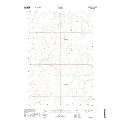
2020 Map of Belfield SE
USGS Topo · Published 2020About this map
Heart River and its various tributaries define the drainage patterns across this section of the North Dakota badlands. The terrain is marked by the S Br Heart River, which meanders eastward through the central portion of the survey, joined by Bull Cr from the south and Norwegian Cr in the northwest. This topography dictates a precise grid of rural section roads, including 126th Ave SW and 45th St SW, which carve the landscape into distinct agricultural and ranching plots.
Find a feature on this map
22 named features on this map. Tap any name to fly to it.
Don’t see what you’re looking for? This feature index may not catch every label — zoom into the map to look around manually.
Map Details
Editions of this 2020 Belfield SE Map
This is the sole edition of this map. No revisions or reprints were ever made.
Other maps of this area

1953 · Dickinson
USGS Topo · 1:250,000

1957 · Dickinson
USGS Topo · 1:250,000

1961 · Daglum
USGS Topo · 1:62,500

1962 · Belfield NE
USGS Topo · 1:24,000

1962 · Belfield SW
USGS Topo · 1:24,000

1962 · Belfield
USGS Topo · 1:24,000

1962 · Belfield SE
USGS Topo · 1:24,000

1973 · New Hradec South
USGS Topo · 1:24,000

1973 · New England NW
USGS Topo · 1:24,000
1973 · South Heart
USGS Topo · 1:24,000