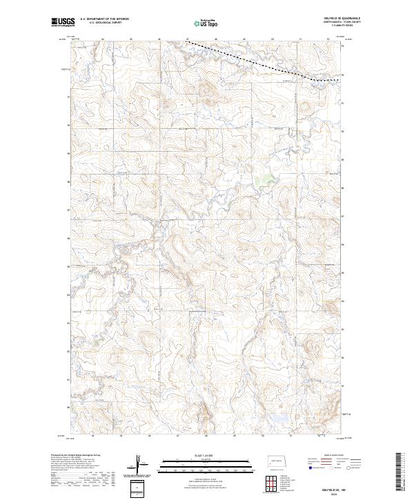
2024 Map of Belfield SE
USGS Topo · Published 2024About this map
The Heart River and its South Branch Heart River define the undulating drainage patterns of Stark County in this 2024 landscape survey. The terrain is structured by a rigorous grid of section lines and gravel roads, including north-south arteries like 126th Ave SW and 125th Ave SW. This area reflects a classic Western North Dakota ranching and agricultural layout where traditional section-line boundaries dictate movement across the plains. In the north, W Main St provides one of the primary east-west corridors, while southern drainages like Bull Creek flow through open country. The lack of dense residential development emphasizes a landscape of large-scale land management, where small seasonal tributaries and coulees shape the local topography around isolated rural routes.
Find a feature on this map
21 named features on this map. Tap any name to fly to it.
Don’t see what you’re looking for? This feature index may not catch every label — zoom into the map to look around manually.
Map Details
Editions of this 2024 Belfield SE Map
This is the sole edition of this map. No revisions or reprints were ever made.
Other maps of this area

1953 · Dickinson
USGS Topo · 1:250,000

1957 · Dickinson
USGS Topo · 1:250,000

1961 · Daglum
USGS Topo · 1:62,500

1962 · Belfield NE
USGS Topo · 1:24,000

1962 · Belfield SW
USGS Topo · 1:24,000

1962 · Belfield
USGS Topo · 1:24,000

1962 · Belfield SE
USGS Topo · 1:24,000

1973 · New Hradec South
USGS Topo · 1:24,000

1973 · New England NW
USGS Topo · 1:24,000
1973 · South Heart
USGS Topo · 1:24,000