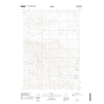
2020 Map of Belfry
USGS Topo · Published 2020About this map
The small community of Belfry anchors the southeastern corner of this Carbon County landscape, situated near the banks of the Clarks Fork Yellowstone River. The geography is defined by a sophisticated system of irrigation channels, including the Shupak Ditch, Golden Ditch, Higham Ditch, and Yount Ditch, which demonstrate the area's agricultural dependence on the river's water. These man-made waterways cut through a terrain of natural drainages such as Bear Cr and the seasonal paths of N Fork Dry Cr and S Fork Dry Cr.
Find a feature on this map
23 named features on this map. Tap any name to fly to it.
Don’t see what you’re looking for? This feature index may not catch every label — zoom into the map to look around manually.
Map Details
Editions of this 2020 Belfry Map
This is the sole edition of this map. No revisions or reprints were ever made.
Other maps of this area

1932 · Red Lodge No 1
USGS Topo · 1:48,000

1944 · Red Lodge
USGS Topo · 1:62,500

1954 · Billings
USGS Topo · 1:250,000

1956 · Bridger
USGS Topo · 1:24,000

1956 · Roberts
USGS Topo · 1:24,000

1956 · The Big Slide
USGS Topo · 1:24,000

1957 · Billings
USGS Topo · 1:250,000

1958 · Billings
USGS Topo · 1:250,000
1969 · Tolman Flat
USGS Topo · 1:24,000
1969 · Hollenbeck Draw
USGS Topo · 1:24,000