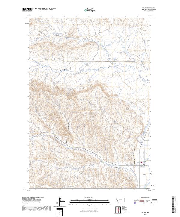
2024 Map of Belfry
USGS Topo · Published 2024About this map
Belfry sits along the eastern edge of this landscape, a settlement defined by its proximity to the Clarks Fork Yellowstone River and the complex irrigation systems supporting local agriculture. A network of man-made waterways, including Shupak Ditch, Higham Ditch, and Golden Ditch, diverts water across the terrain to sustain the valley. The map documents the confluence of Bear Creek and the main river just south of the town center, where the Po and Vaill Ave mark the local hub.
Find a feature on this map
23 named features on this map. Tap any name to fly to it.
Don’t see what you’re looking for? This feature index may not catch every label — zoom into the map to look around manually.
Map Details
Editions of this 2024 Belfry Map
This is the sole edition of this map. No revisions or reprints were ever made.
Other maps of this area

1932 · Red Lodge No 1
USGS Topo · 1:48,000

1944 · Red Lodge
USGS Topo · 1:62,500

1954 · Billings
USGS Topo · 1:250,000

1956 · Bridger
USGS Topo · 1:24,000

1956 · Roberts
USGS Topo · 1:24,000

1956 · The Big Slide
USGS Topo · 1:24,000

1957 · Billings
USGS Topo · 1:250,000

1958 · Billings
USGS Topo · 1:250,000
1969 · Tolman Flat
USGS Topo · 1:24,000
1969 · Hollenbeck Draw
USGS Topo · 1:24,000