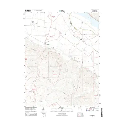
2015 Map of Belgique
USGS Topo · Published 2015About this map
Belgique and McBride sit on the fertile bottomlands along the Mississippi River border between Missouri and Illinois, where the landscape is defined by the shifting paths of the Great River. The Missouri Chute separates the mainland from river-bound landforms like Crains Island and Puckett Island, illustrating the complex hydrology of this alluvial plain. In the southern half of the map, the terrain shifts abruptly into the dissected uplands of Big Hollow, where numerous small waterways like Christisen Br and McClanahan Cr carve through the hills. For genealogists and local historians, the sheet preserves the locations of Nativity Cemetery near the river and Preston Cemetery tucked into the higher ground west of Bois Brule. The presence of the Perryville Municipal Airport near the northern boundary contrasts with the older settlement patterns of Sereno, showing the continued development of this riverfront corridor.
Find a feature on this map
74 named features on this map. Tap any name to fly to it.
Don’t see what you’re looking for? This feature index may not catch every label — zoom into the map to look around manually.
Map Details
Editions of this 2015 Belgique Map
This is the sole edition of this map. No revisions or reprints were ever made.
Other maps of this area

1915 · Chester
USGS Topo · 1:62,500

1916 · Campbell Hill
USGS Topo · 1:62,500

1918 · Altenburg
USGS Topo · 1:62,500

1918 · Campbell Hill
USGS Topo · 1:62,500

1923 · Perryville
USGS Topo · 1:62,500

1924 · Perryville
USGS Topo · 1:62,500

1925 · Altenburg
USGS Topo · 1:62,500

1947 · Chester
USGS Topo · 1:62,500

1947 · Crosstown
USGS Topo · 1:24,000

1947 · Altenburg
USGS Topo · 1:62,500