
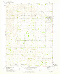
1955 Map of Belgrade SW
USGS Topo · Published 1955About this map
The Loup River dominates this mid-century Nebraska landscape, carving a wide valley through the hills of Nance and Merrick Counties. This agricultural region is defined by a dense network of local education centers, including rural schools such as School No 60, School No 24, and the Midway Sch. A notable historical demarcation, the Old Indian Reservation Boundary, cuts across the southern portion of the quadrangle, reflecting the shifting land use and settlement patterns of the Platte River valley. In the north, North Star serves as a local landmark near the convergence of the hilly Cottonwood and Loup Ferry townships. The map records a transition in the rural landscape, specifically noting several decommissioned educational sites like School No 4 (Abandoned) and School No 61 (Abandoned) which likely served the West Newman area in earlier decades.
Find a feature on this map
17 named features on this map. Tap any name to fly to it.
Don’t see what you’re looking for? This feature index may not catch every label — zoom into the map to look around manually.
Map Details
Editions of this 1955 Belgrade SW Map
This is the sole edition of this map. No revisions or reprints were ever made.
Other maps of this area

1899 · St. Paul
USGS Topo · 1:125,000

1954 · Wolbach NE
USGS Topo · 1:24,000

1954 · Belgrade
USGS Topo · 1:24,000

1954 · Belgrade NW
USGS Topo · 1:24,000

1955 · Broken Bow
USGS Topo · 1:250,000

1955 · Belgrade SE
USGS Topo · 1:24,000

1955 · Cushing
USGS Topo · 1:24,000

1956 · Broken Bow
USGS Topo · 1:250,000
1961 · Palmer
USGS Topo · 1:24,000
1962 · Hord
USGS Topo · 1:24,000