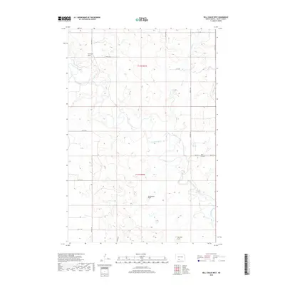
2018 Map of Bell Coulee West
USGS Topo · Published 2018About this map
Thompson Butte and Rattlesnake Butte anchor this section of the North Dakota landscape, where the Cannonball River meanders across the plains of Grant County. The river’s path is joined by several tributaries, including Sixmile Cr, which carves through the terrain south of the Bell Coulee formation. A sparse but precise grid of section lines and gravel routes, such as 53rd Ave SW and 82nd St SW, provides the only structural indicators across the expansive ranchland. The topographical detail reveals a succession of high points and depressions, including the prominent Flat Top Butte, illustrating the erosion patterns characteristic of the region's semi-arid environment.
Find a feature on this map
19 named features on this map. Tap any name to fly to it.
Don’t see what you’re looking for? This feature index may not catch every label — zoom into the map to look around manually.
Map Details
Editions of this 2018 Bell Coulee West Map
This is the sole edition of this map. No revisions or reprints were ever made.
Other maps of this area

1954 · Bismarck
USGS Topo · 1:250,000

1958 · Bismarck
USGS Topo · 1:250,000

1971 · Lookout Butte
USGS Topo · 1:24,000

1971 · Lookout Butte SE
USGS Topo · 1:24,000

1972 · Carson SE
USGS Topo · 1:24,000

1972 · Paradise Flats
USGS Topo · 1:24,000
1972 · Pitt Creek
USGS Topo · 1:24,000

1980 · Brisbane
USGS Topo · 1:24,000

1980 · Bell Coulee West
USGS Topo · 1:24,000

1980 · Bell Coulee East
USGS Topo · 1:24,000