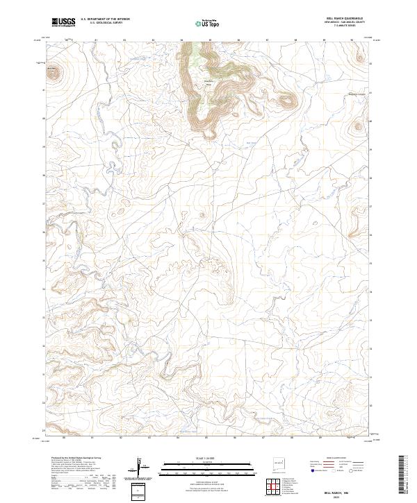
2023 Map of Bell Ranch
USGS Topo · Published 2023About this map
Bell Mtn and Huerfano Mesa anchor this landscape in San Miguel County, where drainage networks define the topography of the High Plains. The map details a complex system of ephemeral waterways, including the winding La Cinta Creek and Seco Creek, which are critical to the region's ranching heritage. Local hydrology is further marked by cattle tanks like Huerfano Tank and Red Tank, essential landmarks in this dry environment. The presence of Bueyeros Canyon and Muertos Creek suggests a terrain shaped by deep erosion, characteristic of northeastern New Mexico's mesa-and-canyon country. This 2023 data provides a modern record of the land within t15n r26e, illustrating the intersection of natural drainage and the enduring cattle-ranching infrastructure of the Bell Ranch area.
Find a feature on this map
11 named features on this map. Tap any name to fly to it.
Don’t see what you’re looking for? This feature index may not catch every label — zoom into the map to look around manually.
Map Details
Editions of this 2023 Bell Ranch Map
This is the sole edition of this map. No revisions or reprints were ever made.
Other maps of this area

1930 · Tucumcari
USGS Topo · 1:125,000

1954 · Santa Fe
USGS Topo · 1:250,000

1954 · Tucumcari
USGS Topo · 1:250,000

1958 · Santa Fe
USGS Topo · 1:250,000

1958 · Tucumcari
USGS Topo · 1:250,000

1968 · La Cinta Mesa
USGS Topo · 1:24,000

1968 · Carpenter Mesa NW
USGS Topo · 1:24,000

1968 · Conchas Dam
USGS Topo · 1:24,000
1969 · Campana
USGS Topo · 1:24,000

1969 · Chinaberry Canyon
USGS Topo · 1:24,000