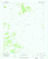
1972 Map of Bell Ranch
USGS Topo · Published 1972About this map
The vast Pablo Montoya Grant landscape of northeastern New Mexico centers on the historic Bell Ranch headquarters in the early 1970s. This ranching terrain is defined by a network of essential water improvements, including Huerfano Tank and West Bronc Tank, along with numerous named windmills such as the Round Top Windmill and Lane Pasture Windmill.
Find a feature on this map
27 named features on this map. Tap any name to fly to it.
Don’t see what you’re looking for? This feature index may not catch every label — zoom into the map to look around manually.
Map Details
Editions of this 1972 Bell Ranch Map
This is the sole edition of this map. No revisions or reprints were ever made.
Other maps of this area

1930 · Tucumcari
USGS Topo · 1:125,000

1954 · Santa Fe
USGS Topo · 1:250,000

1954 · Tucumcari
USGS Topo · 1:250,000

1958 · Santa Fe
USGS Topo · 1:250,000

1958 · Tucumcari
USGS Topo · 1:250,000

1968 · La Cinta Mesa
USGS Topo · 1:24,000

1968 · Carpenter Mesa NW
USGS Topo · 1:24,000

1968 · Conchas Dam
USGS Topo · 1:24,000
1969 · Campana
USGS Topo · 1:24,000

1969 · Chinaberry Canyon
USGS Topo · 1:24,000