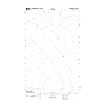
2011 Map of Bell Ridge East
USGS Topo · Published 2011About this map
Cottonwood Creek and its many tributaries, including Little Cottonwood Creek and Siparyann Creek, define the drainage patterns of this Phillips County landscape. The terrain is characterized by broad ridges and isolated high points, most notably Square Butte and the long expanse of Siparyann Ridge in the southeast. In this part of Montana, water management is evident through several named embankments, such as Little Bunny Dam, Square Butte Dam, and Bar Island Dam. These features, along with Lark Dam on Rock Creek, illustrate the historical importance of controlling seasonal runoff for livestock and agriculture. Near the southern boundary, Jones Island sits at the confluence of the local drainage system and Duval Creek.
Find a feature on this map
12 named features on this map. Tap any name to fly to it.
Don’t see what you’re looking for? This feature index may not catch every label — zoom into the map to look around manually.
Map Details
Editions of this 2011 Bell Ridge East Map
This is the sole edition of this map. No revisions or reprints were ever made.
Other maps of this area

1943 · Landusky
USGS Topo · 1:125,000

1954 · Bell Ridge East
USGS Topo · 1:24,000

1954 · Hessler Ridge
USGS Topo · 1:24,000

1954 · Carter Coulee
USGS Topo · 1:24,000

1954 · Bell Ridge West
USGS Topo · 1:24,000

1954 · Lewistown
USGS Topo · 1:250,000

1959 · Lewistown
USGS Topo · 1:250,000

1971 · Robinson School
USGS Topo · 1:24,000

1971 · Hays SE
USGS Topo · 1:24,000
1971 · D Y Junction
USGS Topo · 1:24,000