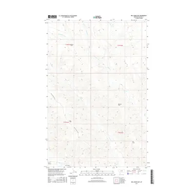
2017 Map of Bell Ridge East
USGS Topo · Published 2017About this map
Square Butte rises above a landscape defined by significant drainage systems and high ridges in this section of Phillips County. The terrain is deeply incised by Little Cottonwood Cr, Cottonwood Cr, and Rock Cr, which carve through the land toward the southern lowlands. These waterways converge near unique topographical features such as Jones Island and the broad Bell Bottoms, providing a detailed look at the hydrology of the Missouri River breaks region.
Find a feature on this map
15 named features on this map. Tap any name to fly to it.
Don’t see what you’re looking for? This feature index may not catch every label — zoom into the map to look around manually.
Map Details
Editions of this 2017 Bell Ridge East Map
This is the sole edition of this map. No revisions or reprints were ever made.
Other maps of this area

1943 · Landusky
USGS Topo · 1:125,000

1954 · Bell Ridge East
USGS Topo · 1:24,000

1954 · Hessler Ridge
USGS Topo · 1:24,000

1954 · Carter Coulee
USGS Topo · 1:24,000

1954 · Bell Ridge West
USGS Topo · 1:24,000

1954 · Lewistown
USGS Topo · 1:250,000

1959 · Lewistown
USGS Topo · 1:250,000

1971 · Robinson School
USGS Topo · 1:24,000

1971 · Hays SE
USGS Topo · 1:24,000
1971 · D Y Junction
USGS Topo · 1:24,000