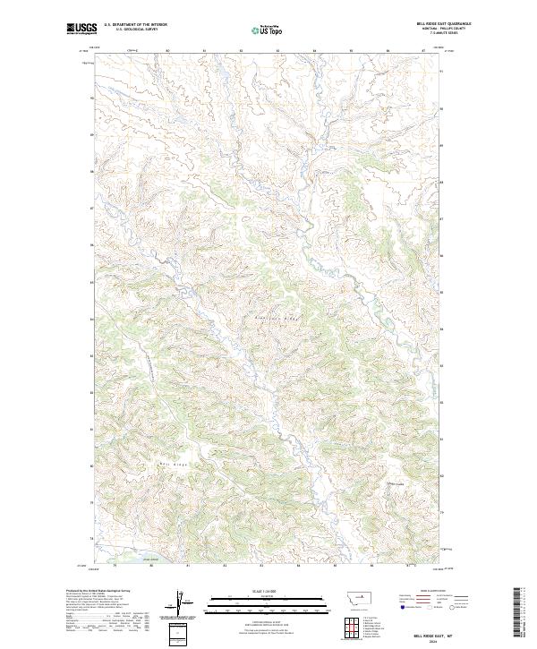
2024 Map of Bell Ridge East
USGS Topo · Published 2024About this map
The Charles M Russell National Wildlife Refuge dominates the landscape of Phillips County, Montana, protecting the extensive drainages of the Missouri River breaks. This 2024 topographic survey highlights the complex drainage networks of Little Cottonwood Creek and Rock Creek, which cut through the high ground of Siparyann Ridge and Bell Ridge. These features reflect a traditional ranching and conservation landscape where geographic names often trace back to early local families and physical landmarks.
Find a feature on this map
14 named features on this map. Tap any name to fly to it.
Don’t see what you’re looking for? This feature index may not catch every label — zoom into the map to look around manually.
Map Details
Editions of this 2024 Bell Ridge East Map
This is the sole edition of this map. No revisions or reprints were ever made.
Other maps of this area

1943 · Landusky
USGS Topo · 1:125,000

1954 · Bell Ridge East
USGS Topo · 1:24,000

1954 · Hessler Ridge
USGS Topo · 1:24,000

1954 · Carter Coulee
USGS Topo · 1:24,000

1954 · Bell Ridge West
USGS Topo · 1:24,000

1954 · Lewistown
USGS Topo · 1:250,000

1959 · Lewistown
USGS Topo · 1:250,000

1971 · Robinson School
USGS Topo · 1:24,000

1971 · Hays SE
USGS Topo · 1:24,000
1971 · D Y Junction
USGS Topo · 1:24,000