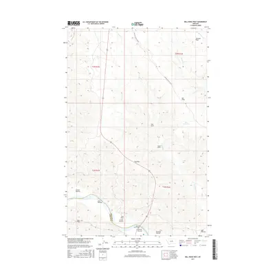
2017 Map of Bell Ridge West
USGS Topo · Published 2017About this map
The Missouri River carves through the southern portion of this landscape, creating a series of named lowlands that define the local geography. These areas, including Kendall Bottoms, Knox Bottoms, Le Clair Bottoms, and Gardipee Bottoms, represent the primary points of historical interest along the river corridor. The terrain rises sharply away from the water towards prominent high points such as Knox Ridge and Siparyann Ridge, while drainage features like Duval Gulch and Bogg Gulch score the uplands. Access through the region is highlighted by the CMR Auto Nature Tour Rd, which traverses the northern reaches. This 2017 survey also documents significant water management features like Bell Reservoir, situated beneath the high ground of Bell Ridge. The boundary between Fergus and Phillips counties is marked directly at the river, anchoring the map's political and physical orientation.
Find a feature on this map
26 named features on this map. Tap any name to fly to it.
Don’t see what you’re looking for? This feature index may not catch every label — zoom into the map to look around manually.
Map Details
Editions of this 2017 Bell Ridge West Map
This is the sole edition of this map. No revisions or reprints were ever made.
Other maps of this area

1943 · Landusky
USGS Topo · 1:125,000

1954 · Bell Ridge East
USGS Topo · 1:24,000

1954 · Hessler Ridge
USGS Topo · 1:24,000

1954 · Carter Coulee
USGS Topo · 1:24,000

1954 · Bell Ridge West
USGS Topo · 1:24,000

1954 · Grand Island
USGS Topo · 1:24,000

1954 · Lewistown
USGS Topo · 1:250,000

1959 · Lewistown
USGS Topo · 1:250,000

1971 · Hays SE
USGS Topo · 1:24,000
1971 · D Y Junction
USGS Topo · 1:24,000