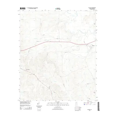
2014 Map of Bellamy
USGS Topo · Published 2014About this map
Bellamy stands as a focal point in this eastern Sumter County landscape, where the Sucarnoochee River and its many tributaries, including Alamuchee Creek and Opossum Cr, carve through the terrain. The map captures a transition between established settlements and rural crossroads, connected by a network of local routes like Lynn Bennett Rd and Al-17. The infrastructure reflects a long-standing agricultural and timber-linked economy, evidenced by the numerous named creek systems such as Cotohaga Cr and Second Cr that drain the territory.
Find a feature on this map
39 named features on this map. Tap any name to fly to it.
Don’t see what you’re looking for? This feature index may not catch every label — zoom into the map to look around manually.
Map Details
Editions of this 2014 Bellamy Map
This is the sole edition of this map. No revisions or reprints were ever made.
Other maps of this area

1929 · Epes
USGS Topo · 1:48,000

1932 · Epes
USGS Topo · 1:62,500

1953 · Meridian
USGS Topo · 1:250,000

1957 · Meridian
USGS Topo · 1:250,000

1965 · Meridian
USGS Topo · 1:250,000

1971 · Whitfield
USGS Topo · 1:24,000

1971 · Coatopa
USGS Topo · 1:24,000

1971 · Gaston
USGS Topo · 1:24,000

1971 · Bellamy
USGS Topo · 1:24,000

1974 · Boyd
USGS Topo · 1:24,000